Therria Fm
Type Locality and Naming
Type section is in the Therriaghat Section. The limestones are 69 m thick while the sandstones are 26 m thick. [Original Publication: Medlicott, H. B., 1869. Geological Sketch of the Shillong Plateau, Mem. Geol. Surv. India vol. VII, pt. 1, pp. 151-207.]
Synonyms: Medlicott (1869) described ‘Cherra band’ as occurring between the ‘Langpar band’ and the Nummulitics. Ghosh (1940) included the lowermost limestone and sandstone bands, overlying the Langpars exposed in the Therriaghat section in his Cherra Sandstone Stage, whereas the overlying three limestone and two sandstone bands were included in the Nummulitics. The interbedded limestone-sandstone sequence in the Therriaghat section was separated by Wilson and Metre (1953) into Therria Stage comprising of Lower Therria and Upper Therria substages. (Pandey and Dave, 1998)
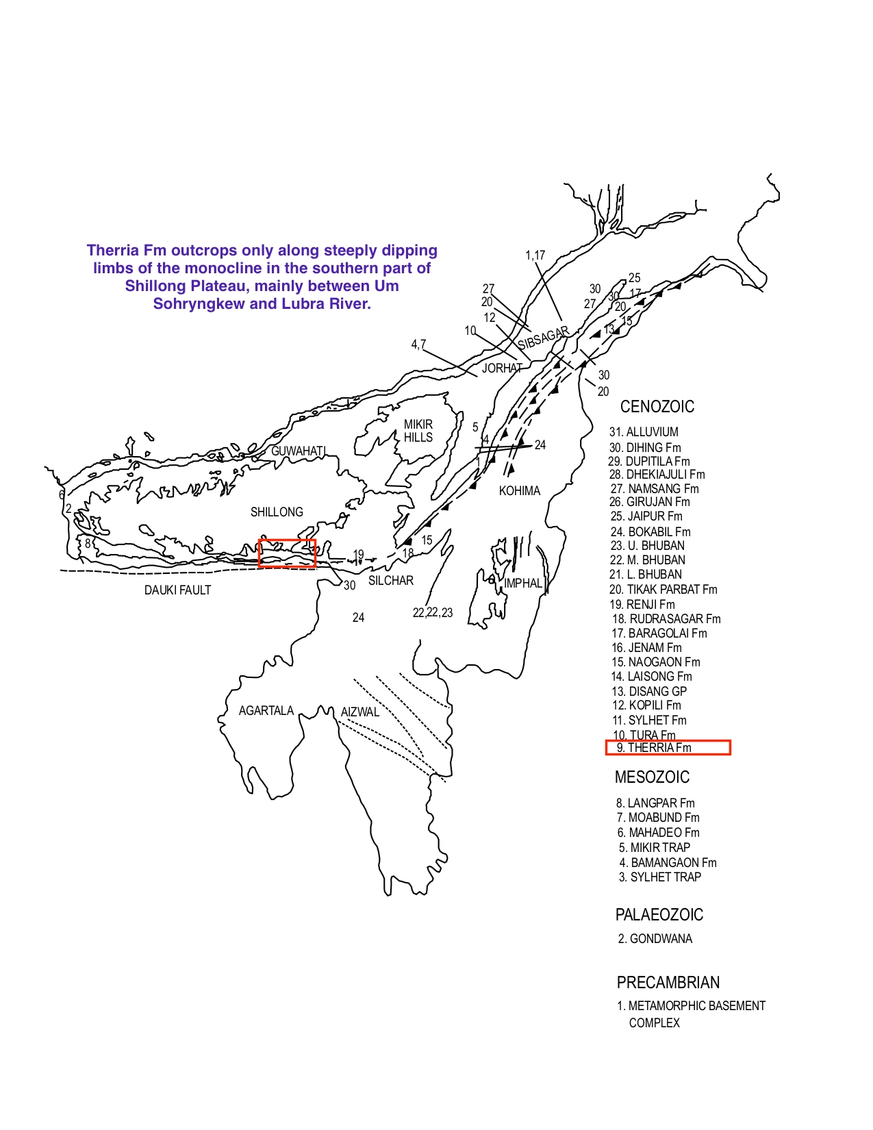
[Figure 1: Formation stratotypes of North East Basins (modified after Pandey and Dave, 1998)]
Lithology and Thickness
Sandy limestone. It consists of massive Lakadong limestone (now Member of Syhlet Fm) at the base followed by sandstones at the top. The Lower Therria substage consisted of limestone, calcareous sandstone, soft sandstone with very few fossils. The Upper Therria substage consisted of sandstones. Therria rock unit is mostly limestone lithotype.
Relationships and Distribution
Lower contact
Gradation and conformable contact with Langpar Fm.
Upper contact
Overlain conformably by a massive LakadongLmsMbr Fm of Sylhet Fm (Sylhet Lakadong Limestone Mbr)
Regional extent
The outcrops of this formation are observed only along steeply dipping limbs of the monocline in the southern part of Shillong Plateau, mainly between Um Sohryngkew and Lubra River. Good exposures of the unit are found in lower Cherrapunjee, Therriaghat in Khasi Hills and Mynkre in Jaintia Hills. Its equivalents are cropping out in Garo Hills, Mikir Hills, while in the suboutcrops, it is recorded from Jorhat, Sibsagar, and Dibrugarh, Tinsukia districts of Assam.
GeoJSON
Fossils
Lower limestone member is poorly fossiliferous yielding algal remains and rare foraminifera. The coals in the Upper sandstone member yield leaf impressions.
Age
Depositional setting
Shallow lagoon to fluvial.
Additional Information
